
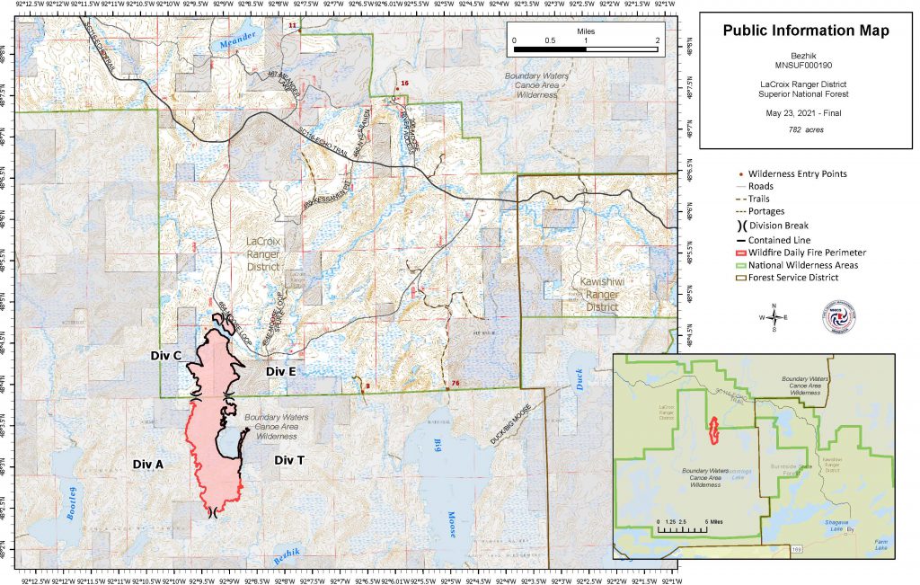
- Size: 782 acres
- Detected: May 17, 2021
- Location: Superior National Forest within the BWCAW northwest of Bezhik Lake.
- Incident Management Team: MNICS Team B, Incident Commander Tom Roach
- Cooperating agencies: USDA Forest Service, Minnesota DNR, St. Louis County Emergency Management, St. Louis County Sheriff’s Office, Virginia MN Fire Department EMS
Late in the day on Monday, May 17, 2021, a wildfire, believed to be started by a lightning strike, was detected northwest of Bezhik (Beige-ik) Lake in the Boundary Waters Canoe Area Wilderness (BWCAW) on the LaCroix Ranger District of the Superior National Forest. Bezhik Lake is located west of Big Moose Lake, north of Cummings Lake, and approximately 16 miles north of Tower, MN.
The fire’s initial progression moved through open pine understory and aspen ground litter, and some single tree torching was initially observed. The fire was estimated to be 950 acres in size.
During the afternoon of May 18, during hot, dry, and windy conditions, the fire made a two-mile run to the north and impacted private property. Numerous air water drops were made by four Fire Boss air tankers and two Large Air Tanker airplanes that helped to hold the fire up just south of the Moose Loop Road. Due to the challenging location for firefighter access, the fire suppression strategy took into consideration firefighter and public safety.
The Superior National Forest ordered a Minnesota Incident Command System (MNICS) Type 3 Incident Management Team to take command of the fire and provide additional support. Team B led by Tom Roach assumed command of the fire at 6am on May 19, 2021. The Superior National Forest implemented a Closure Order that included Forest Road 464 (Moose Loop), Forest Road 465, BWCAW Entry Point #8 Moose River South, and BWCAW Entry Point #76 Big Moose Trail.
With minimal fire growth observed along the perimeter after the transfer to the team took place, fire crews were able to approach the fire’s edge to assess the conditions and develop the strategies needed to work directly on the fire. The fire did exit the BWCAW near the south end of Forest 464 (Moose Loop) on May 18, 2021 and impacted private property in the area. Firefighters continued to engaging in structure protection on private lands and worked to cool down hot spots or pockets of flames that could have threaten private property.
As rain moved through the area on May 20, fire activity remained minimal. Crews began identifying locations to start hoseline to bring water to the fireline and pumps, hoses and supporting equipment was brought in and distributed to areas on the fire where needed. An on-site assessment confirmed that four structures on private property were destroyed when the fire exited the Wilderness near the Moose Loop road. One cabin and three outbuildings were lost. Firefighters continued making sure that the fire areas around structures that remained on private property were extinguished.
An infrared flight on May 21 confirmed no new growth had occurred, and a map was created for fire crews to use on the ground to help locate and extinguish hot spots along the fire’s edge. With improved mobility on the ground, improved mapping efforts were completed and the size of the fire was determined to be 782 acres.
On May 23, 2021, MNICS Team B declared the fire to be 100% contained, and efforts moved to patrolling and monitoring the fire perimeter watching for hotspots. MNICS Team B transferred the command of the fire with the local west zone fire organization the evening of Sunday, May 23, 2021.
The closure order that was in place for Forest Road 464 (Moose Loop), Forest Road 465, BWCAW Entry Point #8 Moose River South, and BWCAW Entry Point #76 Big Moose Trail was rescinded at 9:00am on Monday, May 24, 2021.
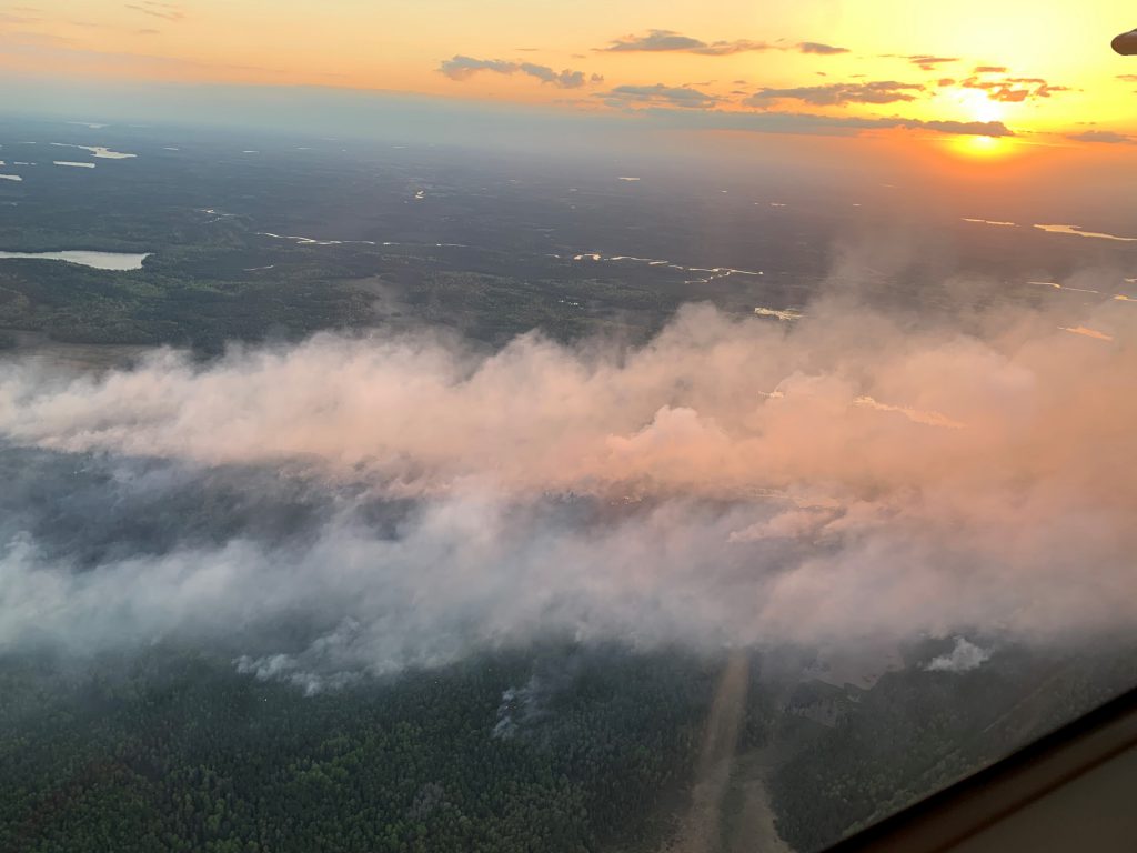
Sunset view from the sky of the Bezhik fire during initial attack aircraft response. 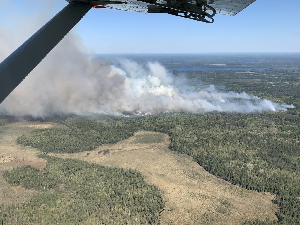
An aerial view of the Bezhik fire during initial response. 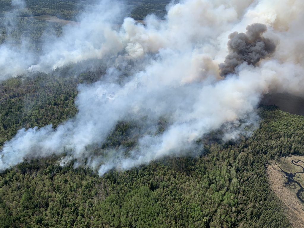
An aerial view of the Bezhik fire during initial response. 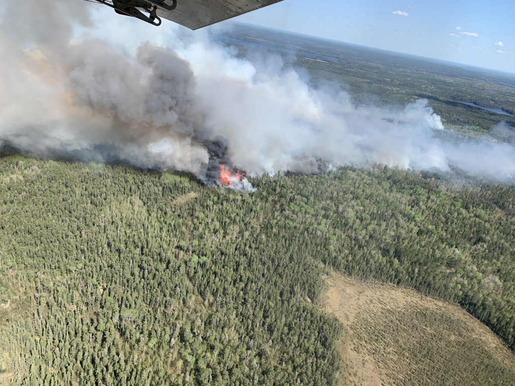
An aerial view of the Bezhik fire during initial response. 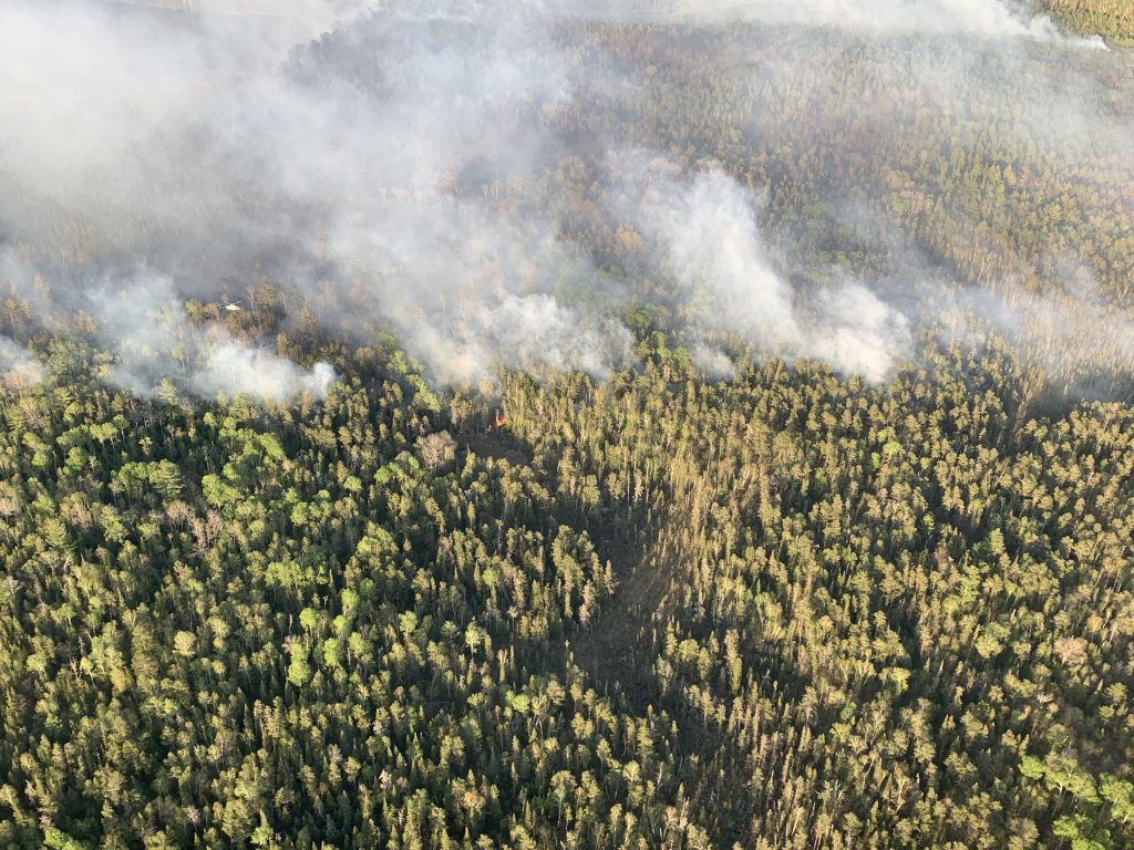
An aerial view of the Bezhik fire during initial response.