- Size: 5,530 acres
- Detected: May 1, 2021
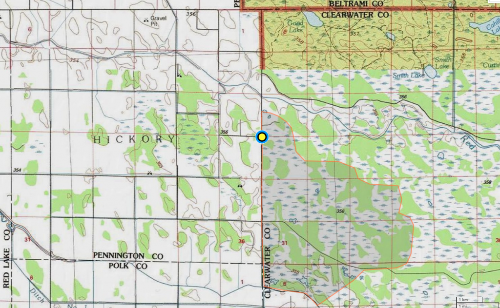
- Location: 20 miles northwest of Red Lake, Minnesota in Clearwater County
- Incident Management Team: MNICS Team B, Incident Commander Tom Roach
- Cooperating agencies: Bureau of Indian Affairs, Red Lake Band of Chippewa, Fond du Lac Band of Lake Superior Chippewa, Minnesota Department of Natural Resources
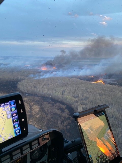
The Goods Fire was detected late morning on May 1, 2021 approximately 20 miles northwest of Red Lake, Minnesota. The fire actively ran through grass, brush, and timber, threatening structures during Red Flag Warning conditions. The dry and windy conditions contributed to fire growth during the afternoon hours as the fire grew to an estimated 1200 acres threatening structures. Several aircraft, including an air attack, two Fire Boss air tankers, six single engine air tankers (SEAT), a large air tanker (LAT), and two helicopters were used for fire suppression.
Due to the size and complexity of the fire, a Minnesota Type 3 Incident Management Team (MNICS Team) B, led by Incident Commander Tom Roach, was ordered to manage the fire. Team B assumed command of the fire at 6:00 a.m. on May 2, 2021.
Fire crews scouted the fire perimeter, prepared additional fire personnel and equipment, and developed suppression actions on the initial day under the management of MNICS Team B. On the western and southwest sides of the fire, crews continued to secure the fire’s edge. On the eastern side, there was some active fire in the swamp grasses. The north and northeast sides of the fire remained quiet.
Tracked vehicles were utilized throughout the fire suppression and mop up efforts to identify safe access routes and complete fire suppression work along the fire’s perimeter. Both direct and indirect operations were implemented based on fire behavior and access. Pockets of burning peat were identified along the west side of the fire.
A temporary flight restriction was ordered for the airspace above the Goods fire due to the continued use of aviation operations. In addition, three helicopters were assigned to the fire and provided bucket water drops to cool off areas of heat.
Cooler temperatures, higher humidity levels, and light rain helped fire crews gain containment efforts on the Goods Fire. Firefighters worked on securing the fire edge and cooling pockets of flames and heat as necessary around the perimeter of the fire. Most of the work was supported by tracked vehicles with water tanks and firefighters on the ground with support from helicopter water bucket drops. A series of helicopter flights with an infrared camera were completed to map the edge of the fire and mark areas of heat that helped in directing ground crew actions. By Wednesday, May 5, the fire was estimated to be 40 percent contained.
Over the next two days, firefighters and equipment continued making significant progress toward securing the fire edge and continuing to cool down pockets of heat when necessary around the perimeter of the fire. By Thursday, May 6, the fire was declared 100 percent contained. MNICS Team B returned the management of the fire to the local fire organization at the end of the shift on May 6.
The local organization continued to monitor the fire area for scattered hot spots and cooling them down as necessary. The TFR that was in place was released on Thursday, May 7, 2021.