
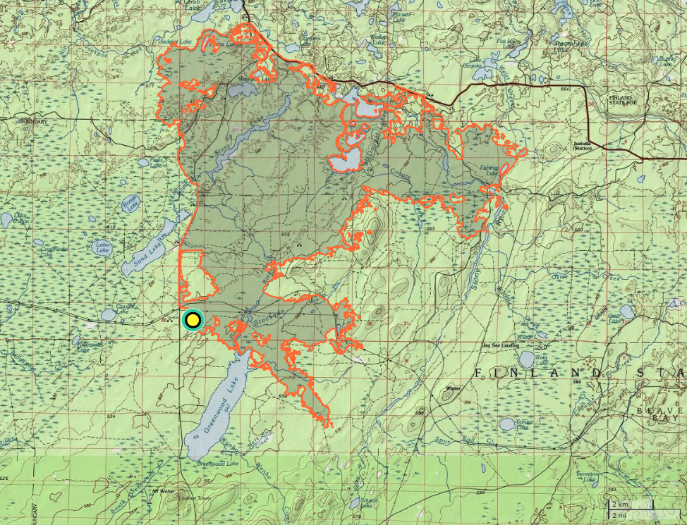
- Size: 26,797 acres
- Detected: August 15, 2021
- Location: Superior National Forest, 15 miles southwest of Isabella, Minn.
- Incident Management Team:
- Eastern Area Type 2 Incident Management Gold Team – Brian Pisarek, Incident Commander (8/18 – 9/2)
- Northern Rockies Type 2 Incident Management Team 3 – Mike Almas, Incident Commander (9/2 – 9/14)
- MNICS Type 3 Team C – Jim Edgar, Incident Commander (9/14 – 10/1)
- Cooperating agencies: USDA Forest Service, Minnesota DNR, Lake County Sheriff
The Greenwood fire was detected in the afternoon hours on August 15 near Greenwood Lake, 15 miles southwest of Isabella, Minn. Driven by gusty winds, dry vegetation, and warm conditions, the Greenwood fire was initially estimated to be 200 acres in size with crowning and spotting contributing to rapid growth
While aircraft and ground resources responded, residents in the McDougal Lake area were notified to prepare for a possible evacuation. The Superior National Forest immediately implemented public safety closures in and around the McDougal Lake area.
The fire was estimated to have grown to 1,000 acres by August 16, as southerly winds continued to push the Greenwood fire northward. Unified command was established between the Superior National Forest and Lake County, and an Eastern Area Type 2 Incident Management Team was ordered.
Lake County placed the McDougal Lake area under evacuation, which included 75 residents. The impacts from smoke, ash and active fire forced the closure of Lake County Highway 2 and State Highway 1.
The Superior National Forest expanded the closure order impacted by the Greenwood fire that encompassed many campgrounds, trails, and boat launches. Several aircraft were brought in to help limit the fire’s spread to the north, as southerly winds continued to contribute to extreme fire activity and produced long range torching. By the evening hours of August 16, the fire had reached 2,000 acres in size.
Additional closure orders, including a small portion of the BWCAW, were applied across the Kawishiwi, Laurentian and Tofte Ranger Districts by the Superior National Forest on August 17. A Red Cross shelter was set up at the Finland Community Center for the residents displaced from the evacuation order.
The Eastern Area Type 2 Incident Management Gold Team, led by Incident Commander Brian Pisarek, assumed management of the Greenwood Fire on the morning of August 18. The fire had reached 3,200 acres and no established containment had been gained.
Ground crews continued full suppression and sought out suppression opportunities along the east and west sides of the fire. Engines, dozers and tracked vehicles began building a fireline along the south end of the fire near Greenwood Lake as helicopters and fixed wing aircraft continued to drop water to cool the advancing flames along the north side of the fire. Air quality alerts were issued for the area and would remain in effect for three days. By the evening hours of August 18, southeast winds pushed the fire west then north with active growth along the west side perimeter, south of Stone Lake. The fire had reached 4,000 acres.
The fire grew another 700 acres throughout the day on August 19. At this point in the fire management effort, there were 145 personnel 25 engines, two dozers, three water tenders, and three aircraft assigned to the fire. Structure protection crews were well into identifying threats and carrying out structure protection, which involved defensible space mitigations. Crews were running day and night shifts, constructing fireline and laying hose along the south side of the fire during the day and patrolling and monitoring fire activity at night. The first of many public meetings commenced on the evening of August 19 at Wolf Ridge Environmental Center in Finland, Minn.
Equipment and personnel continued to expand with 253 personnel assigned on August 20. Resources included three hand crews, 38 engines, two dozers, three tenders and three aircraft assigned, while numerous unassigned aircraft continued to contribute support throughout the Greenwood fire incident. Critical fire weather conditions were again a contributing factor to extreme fire behavior. As a result of the weather conditions, the Greenwood fire jumped from the east side of Highway 2 (a designated Management Action Point or M.A.P.) to the west side. The progression of the fire to the west triggered evacuations in the Jackpot, East and West Chub lakes, and Slate Lake. The fire grew to 8,862 acres and remained zero percent contained.
As the fire progressed northeast into the McDougal Lake area, it forced firefighters and structure protection crews to retreat to safety. All aviation, equipment, and crews working the fire were pulled off due to safety concerns. Additional evacuations were also ordered, including the evacuation of 159 dwellings north of Highway 1 and east of Slate Lake. The Red Cross Center moved their evacuation center to the Babbitt Municipal Center.
Improvements to weather conditions helped moderate fire activity. The fire was estimated to be 21,720 acres. As a result of the fire’s run that occurred on August 23, suppression work expanded to the east and south, and a more secure fireline was located along the south end of the fire. Improved conditions allowed for structure protection crews to resume efforts in the McDougal Lake area and along Lake County Highway 2.
The Superior National Forest implemented additional closures on national forest lands and roads along the upper portion of the Gunflint Trail on August 25. The closure did not include county and private roads.
Defensive firing operations that involved air resources, engines, and bulldozers were conducted along the north and west sides of the fire, which helped to reduce natural flammable fuels near homes and the highway. Logging efforts were also underway along U.S. Highway 1, as trees were to selectively remove trees along with brush that could carry fire. Aesthetics along the Highway 1 corridor were considered during the tree selection and removal process.
By August 26, the Greenwood fire reached 25, 991 acres and remained at zero percent containment. Resources continued growing, as 479 personnel, including cooperators and contractors, were assigned to the fire. Defensive firing operations continued along the southwest side of the fire along Highway 1 and County Highway 2.
Fire crews continued to work on holding and improving firelines. As resources continued to arrive, the Incident Command Post relocated to the Finland Community Center in Finland, Minn.
The Eastern Area Gold Team assumed management of the John Ek and Whelp fires, located north of Tofte in the BWCAW, on August 27. The Superior National Forest closed dispersed camping on all Superior National Forest lands outside of designated campgrounds on August 27.
Containment of the Greenwood fire began to grow by August 28. The fire remained at 25,991 acres and due to the suppression and fireline efforts, it had reached 14 percent containment.
The local community’s desire to support the firefighters with food donations created black bear safety concerns and another layer of a logistical challenge. Communication outreach efforts explained the generosity increased bear activity posing a risk to firefighter safety within the established fire camp, and donations were no longer accepted at fire camp.
Improvements to the weather moderated fire activity, and containment continued to grow. On August 31, the fire was reported to be 26,028 acres and 37 percent contained. Fire crews were making substantial progress, constructing nearly a half mile of fuel break daily. Fire support at this time reached 505 personnel.
On September 2, the Eastern Area Gold Team transitioned management of the fires with the Type 2 Northern Rockies Team 3, led by Incident Commander Mike Almas.
The closure order and evacuated section of Highway 2 was lifted on September 3. The Greenwood fire was reported to be 26,089 acres in size, and 484 personnel were assigned to the fire. Crews focused efforts on securing the western and northern perimeter, while completing mop up as hotspots were discovered.
The Lake County Sherriff’s Office began issuing security pass cards on September 6 to all primary resident homeowners in the restricted Isabella area along Highway 1.
As mop up and patrol continued to expand, resources were slowly being released. By September 7, the Greenwood fire was reported to be 26,112 acres and 49 percent contained. On September 10, Highway 2 had fully reopened to all traffic. Firefighting efforts shifted to mop up along the Highway 1 corridor, as patrol and monitoring continued along Highway 2. The fire was reported to be 26,797 acres and 54 percent contained.
The Northern Rockies Incident Management Team 3 transitioned management of the Greenwood Fire to MNICS Type 3 Team C, led by incident Commander Jim Edgar on September 14.
The Superior National Forest lifted the remaining closures along the Gunflint Trail on September 15 and lifted fire restrictions across all Superior National Forest system lands on September 17. The fire remained at 26,797 acres and was 80 percent contained. Assigned fire personnel had declined to 196. Rehabilitation work to minimize potential for erosion along highways, roads and containment lines had begun.
Highway 1 reopened on September 20. Portions of the Greenwood fire closure area were reopened on September 21. As fire activity remained minimal, and containment reached its highest level of 80 percent, the decision was made to transition management of the Greenwood fire to the Superior National Forest on Oct 1. Fire personnel from the Tofte Ranger District continued monitoring the Greenwood fire, and the Superior National Forest once again reduced the closure around the Greenwood fire.
A tactical burn along Hwy 1. Photo retrieved from the Superior National Forest Facebook post on August 26, 2021. 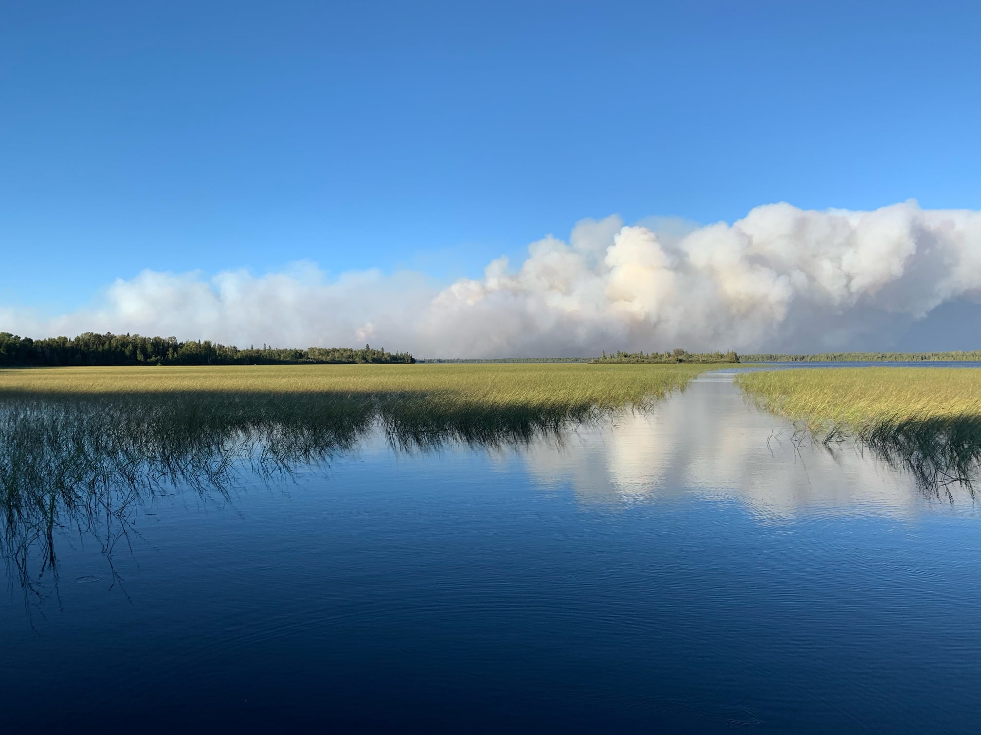
A view from the Greenwood Lake boat landing on August 23, 2021. Photo retrieved from the Superior National Forest Facebook post on August 26, 2021. 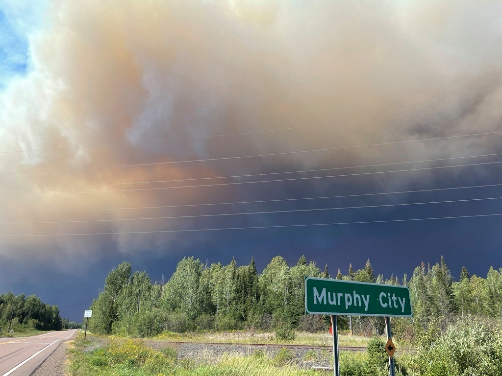
A view of the Greenwood Fire along Highway 1. Photo retrieved from Superior National Forest Facebook post on August 24, 2021. 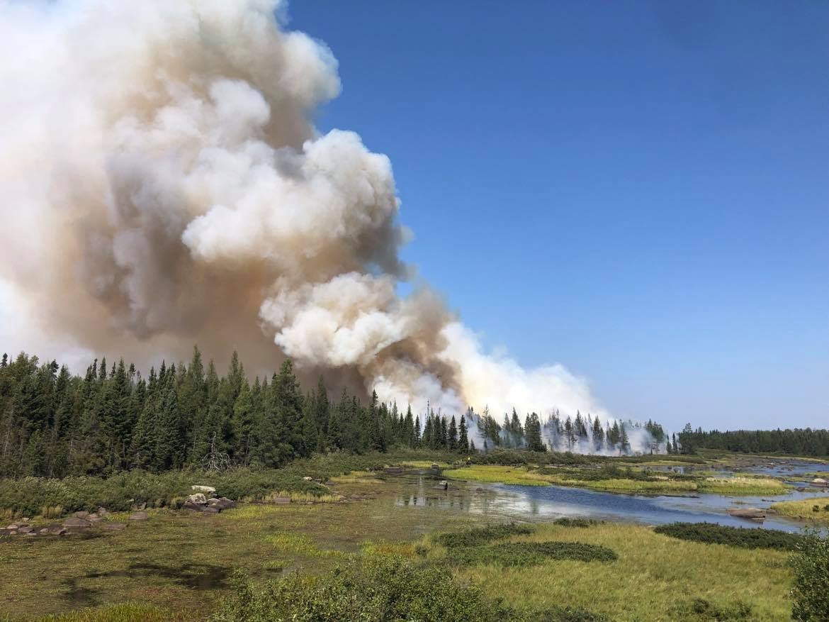
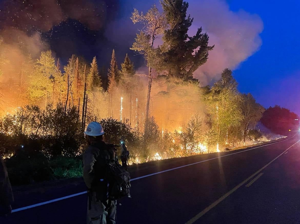
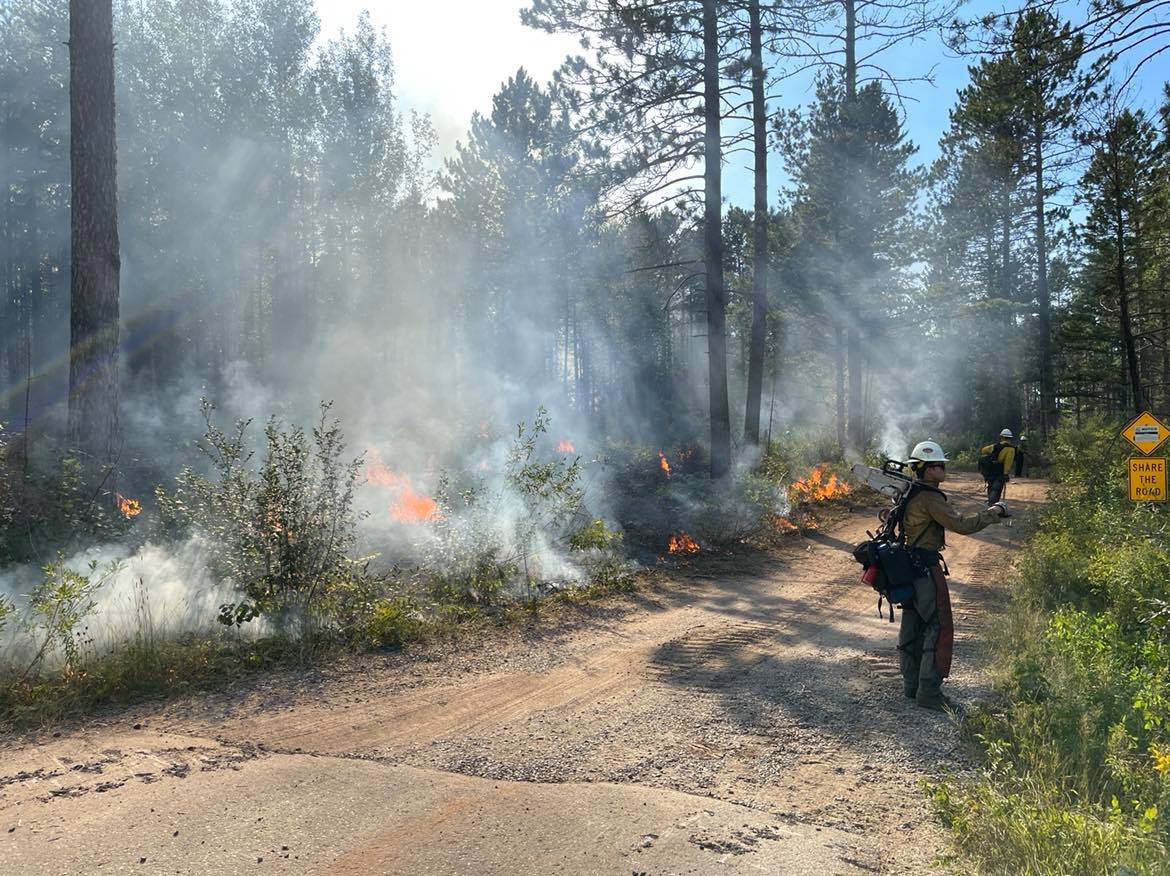
A defensive burn-out operation on the southeastern edge of the fire. Photo retrieved from Superior National Forest Facebook post on August 23, 2021. 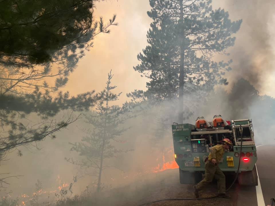
A view from the Greenwood fire line. Photo retrieved from Superior National Forest Facebook post on August 23, 2021. 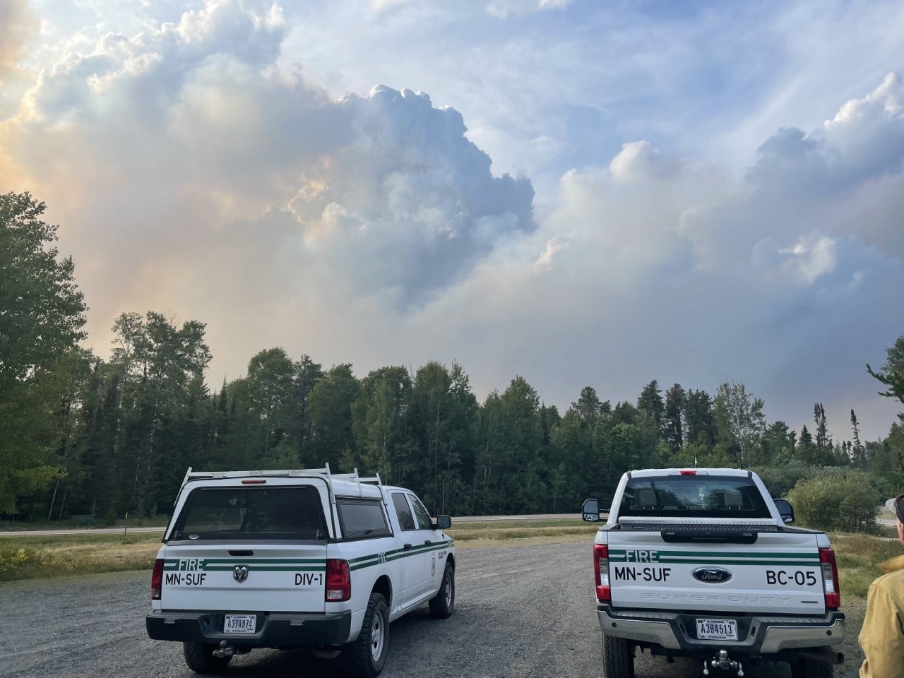
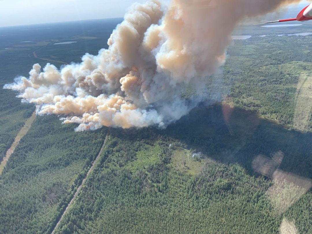
Smoke from the Greenwood Fire the afternoon of August 20, 2021. Photo retrieved from Superior National Forest Facebook post on August 21, 2021 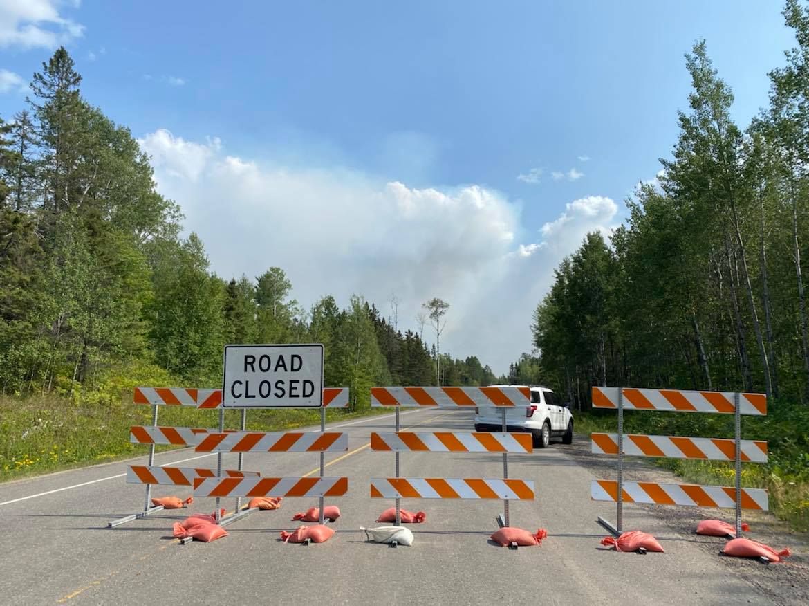
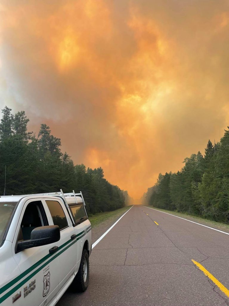
Road closure along Highway 1 due to the Greenwood fire. Photo retrieved from Superior National Forest Facebook post on August 20, 2021.