
- Size: 12,907 acres
- Detected: March 29, 2021
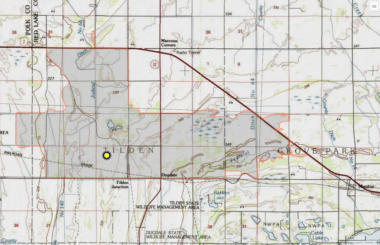
- Location: Red Lake County, Minn., within the Glacial Ridge National Wildlife Refuge, west of Mentor, Minn.
- Incident Management Team: MNICS Team A, Incident Commander Ernest Schmitt
- Cooperating agencies: U.S. Fish and Wildlife Service, Minnesota Department of Natural Resources
During the late afternoon hours of Monday, March 29, 2021, a wildland fire was detected within the Glacial Ridge National Wildlife Refuge, approximately seven miles west of Mentor, Minnesota. Red flag conditions, including strong gusty winds, unseasonable warm temperatures amid prolonged moderate drought conditions (building since the fall of 2020), contributed to the rapid progression of the Oxcart fire. The fire consumed 12,907 acres of grassland and brush.
Initial attack response included ground wildland fire crews from U.S. Fish and Wildlife Service, Minnesota DNR, and 12 local fire departments, along with five single-engine air tankers, a large air tanker, and a helicopter. Smoke and the rapid-fire progression prompted the temporary closures of U.S. Highway 2, State Highway 32, and Polk County Highway 45 during the evening hours as the fire jumped the U.S. Highway 2 corridor to the north, and State Highway 32 to the west.
A Minnesota Incident Command Team, led by Incident Commander Ernest Schmidt, was requested to assume management of the Oxcart fire on Tuesday, March 30, 2021. The team coordinated the operational, planning and logistical support of managing the fire crews and equipment supporting the containment efforts of the fire. Spring weather conditions brought a mix of blustery conditions, rain, and freezing temps. During periods of freezing temperatures, the use of helicopter buckets could not be utilized due to equipment icing over.
The team remained in command of the fire through Saturday, April 2, 2021, when they transitioned management of the fire to a smaller local fire organization. Throughout the 2021 wildfire season, lingering pockets of peat soil heat continued to manifest within the burn scar area as conditions progressed toward extreme drought. U.S. Fish and Wildlife Service monitored the burn area throughout the season, extinguishing the heat pockets as they were identified.
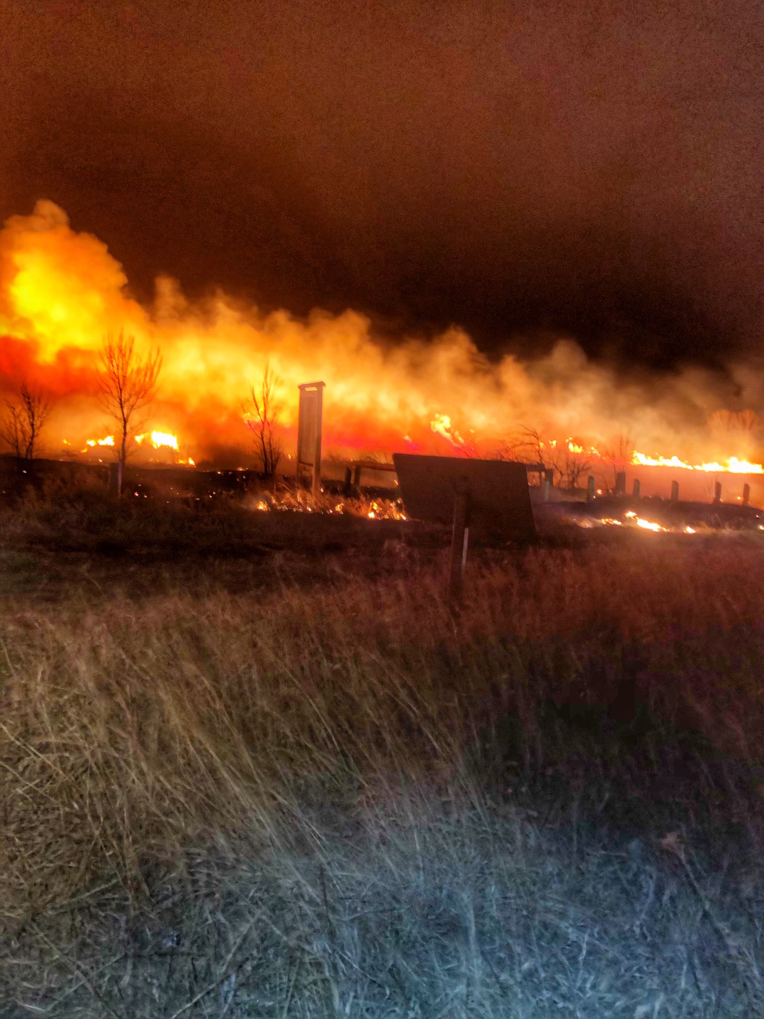
Oxcart fire activity continued into the night, burning through many acres of the Glacial Ridge National Wildlife Refuge. 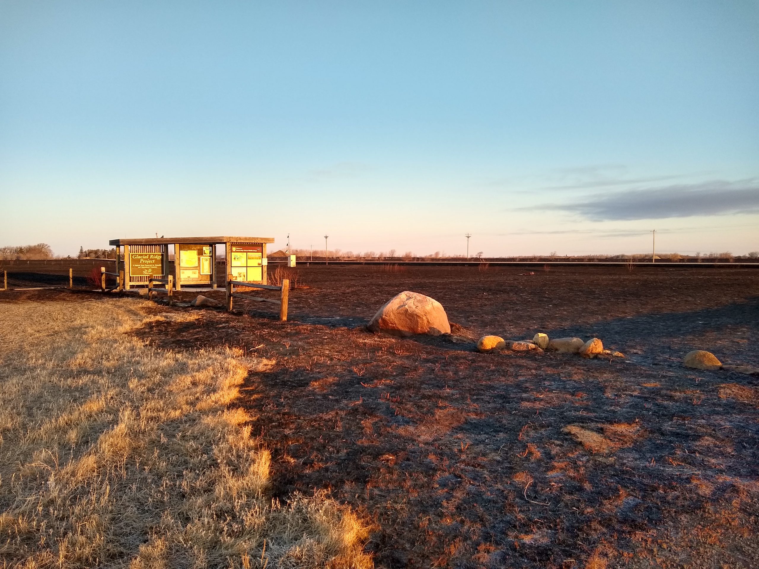
The Oxcart fire moved swiftly through Glacial Ridge National Wildlife Refuge, backing down to smoldering hotspots by morning. 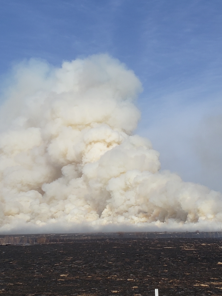
Building drought conditions mixed with a lack of snow and a warm, windy front allowed the Oxcart fire to spread rapidly. 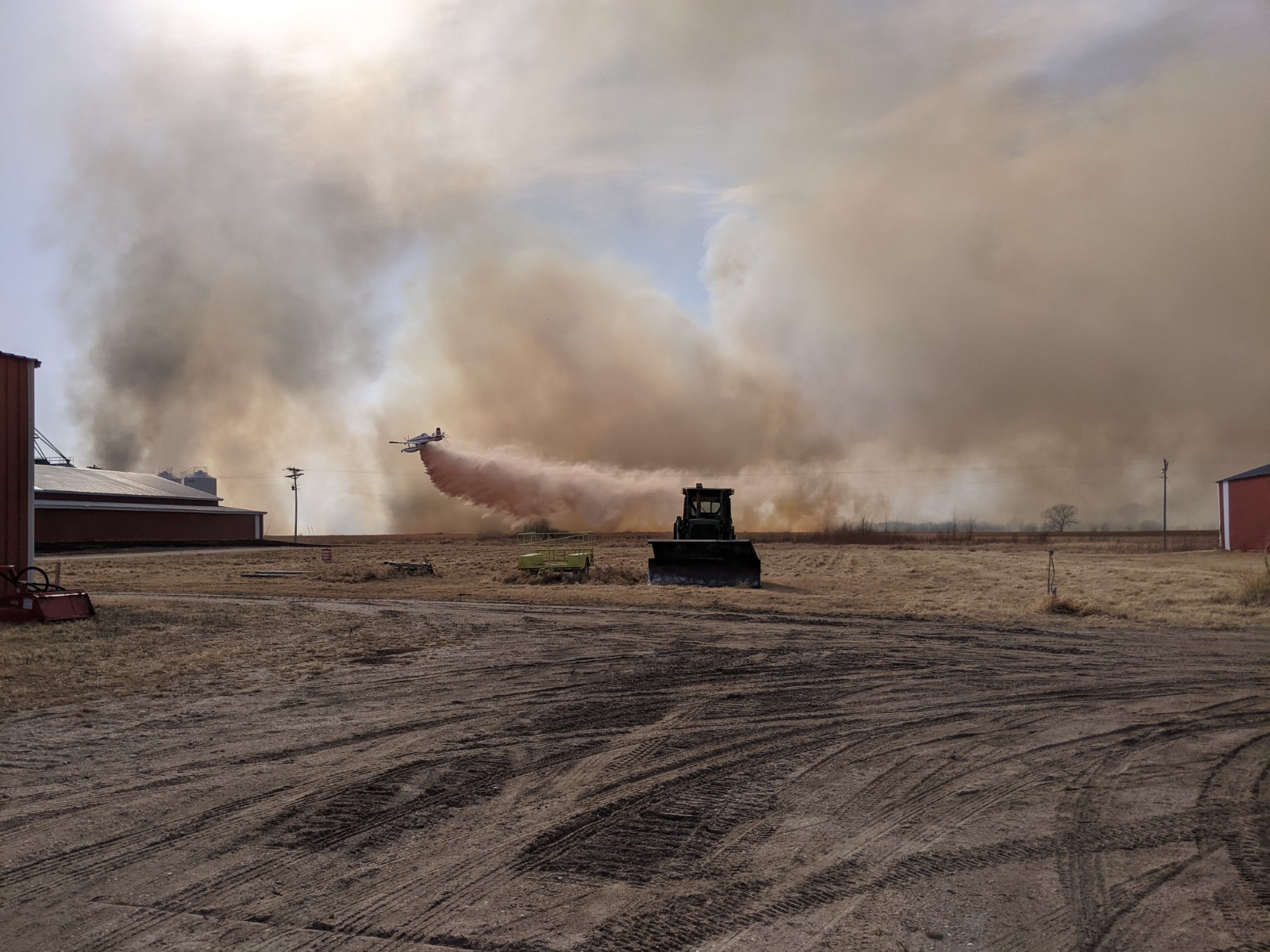
Aircraft, like the Fire Boss dropping water near farm equipment and buildings, helped slow the rapidly growing Oxcart fire. 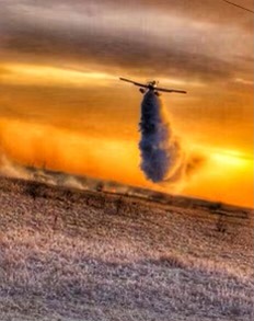
Aircraft remained on scene until sunset, adhering to safety protocols. Ground crews remained throughout the night. 
The rapid transition from warm temperatures to freezing temperatures with scattered snow showers made mop up work with helicopter bucket drops on the Oxcart fire a challenge. 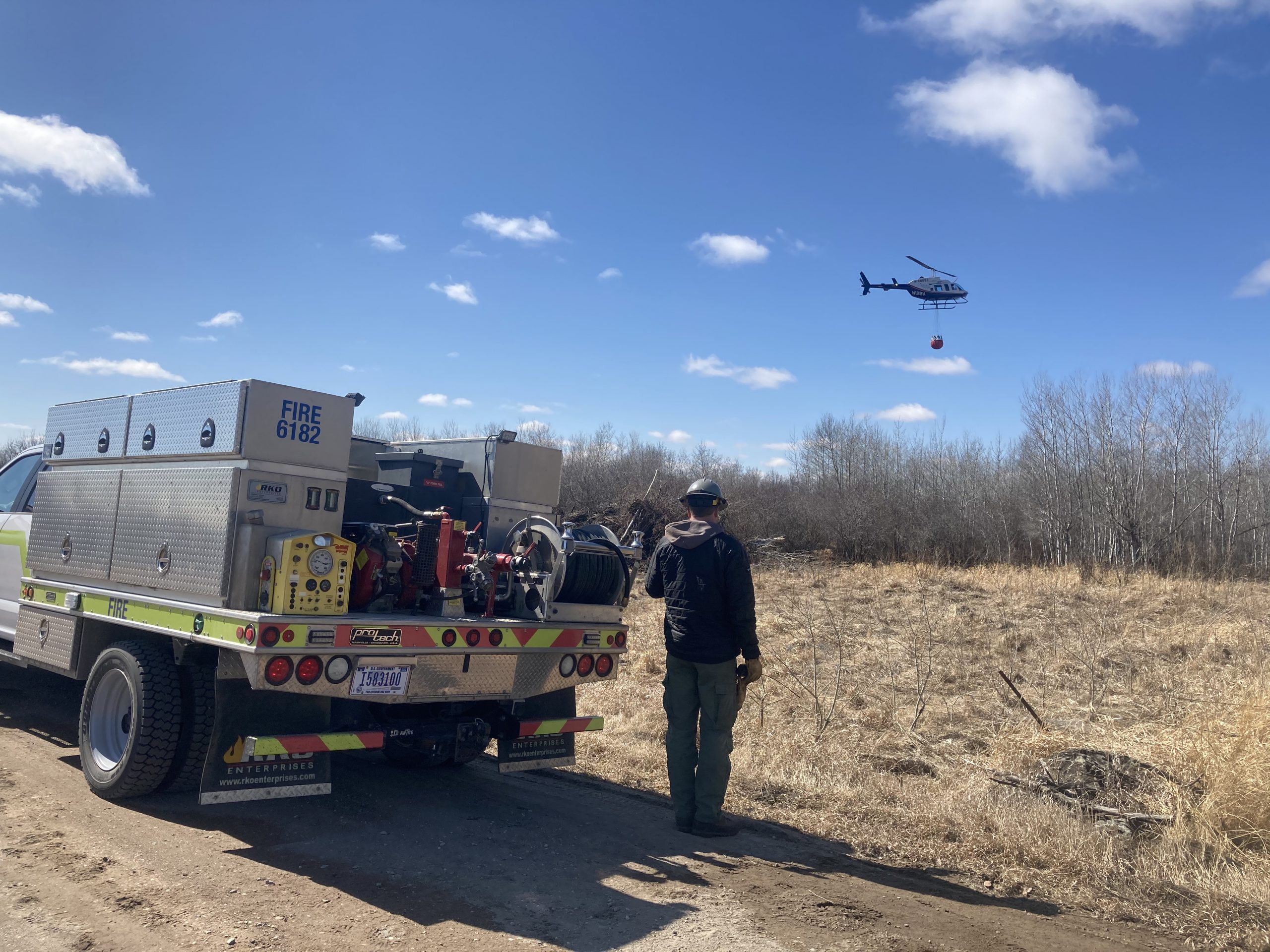
Cooling hotspots with helicopter bucket drops continued the next several days as cold temperatures allowed. 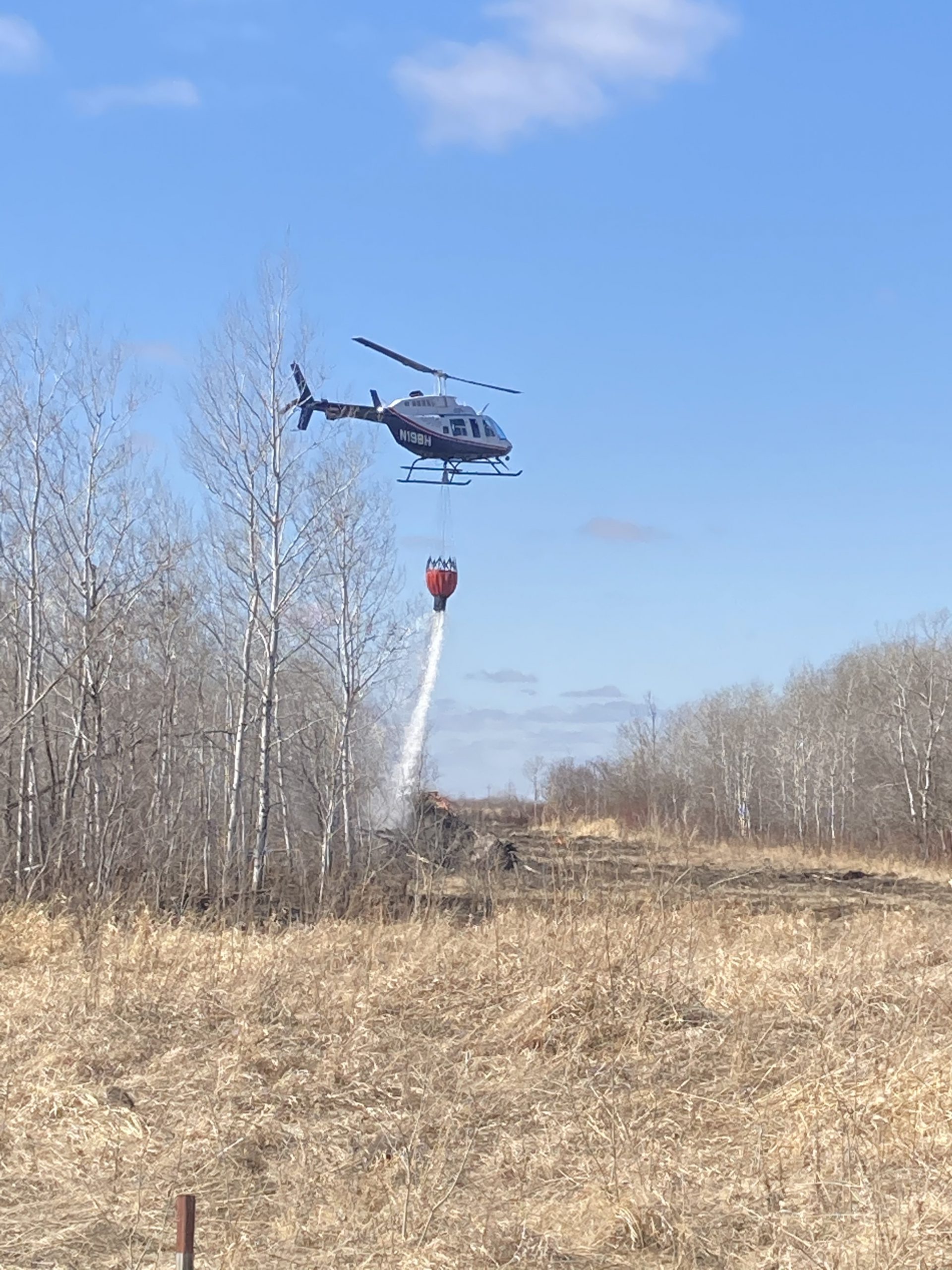
Cooling hotspots with helicopter bucket drops continued the next several days as cold temperatures allowed. 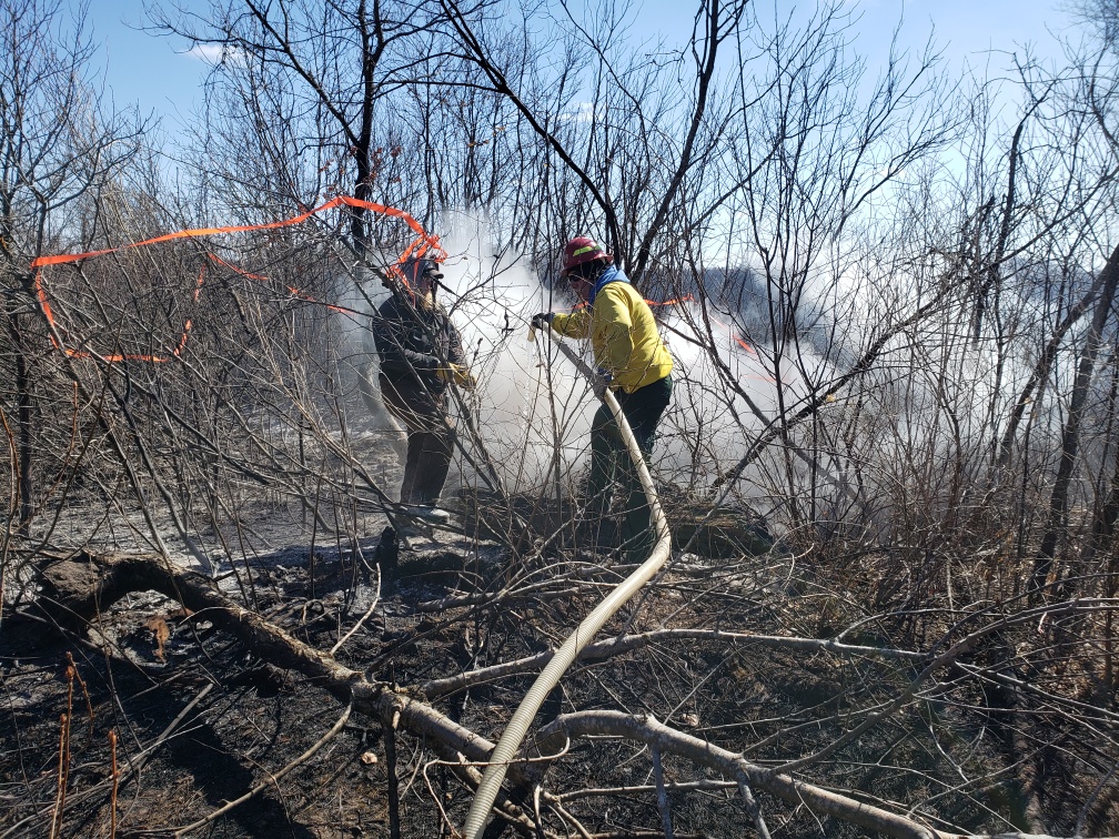
Ground crews mop up a smoldering hotspot in a brush area along the Oxcart fire perimeter.