
- Size: 82 acres
- Detected: September 4, 2023
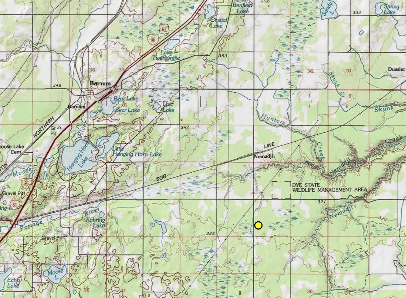
- Location: Carlton County – Southeast of Barnum, Minn.
- Incident Management Team: MNICS Team B-Incident Commander Aaron Mielke
- Cooperating Agencies: Minnesota Department of Natural Resources, U.S. Fish and Wildlife Service, U.S. Forest Service, and mutual aid from Barnum, Moose Lake, Black Hoof, and Carlton Fire Departments, Carlton County Emergency Management and Carlton County Sherriff’s Office
County Rd 11 Fire Update – Wednesday, September 13, 2023
| County Rd 11 Fire Quick Facts |
| Size: 82 acres Location: Barnum, MN Start Date: 9/4/2023 Containment: 100% Cause: Under Investigation Resources: 1 – dozer, 2 – excavators, 6-tracked vehicles, & 1 crew Total Personnel: 42 Updated 9/13/2023 @8:55 a.m. |
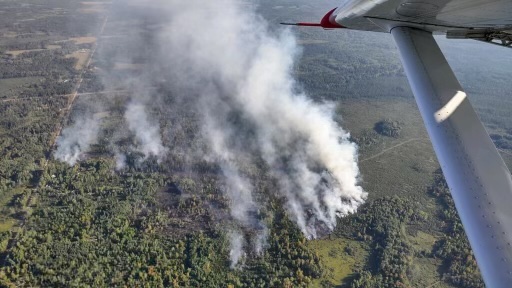
Summary: The County Road 11 fire was detected in a swamp marshland near the Carlton County Roads 8 and 11 crossroads on September 4. Extreme temperatures in the 90s and dry and windy conditions contributed to the rapid-fire growth through swamp marshland grasses and trees. The fire threatened nearby structures. Water-dropping aircraft were brought in to help cool and slow the active fire as firefighters from Minnesota DNR and four local fire departments responded. Initially, six residences were evacuated by the Carlton County Sherriff. The fire activity calmed toward sunset, though it was not considered contained, and local fire departments remained on the scene to monitor the fire’s activity.
Wednesday, September 13, 2023
Note: This is the last County Road 11 Fire Update.
Operations: Most assigned resources will conduct a final patrol and mop up the fire. One senior firefighter and two tracked vehicles will remain assigned to the fire to continue monitoring and patrolling for a few days as needed.
Fire managers and county foresters developed a rehabilitation plan that some resources will start executing. Resources are also checking the fire perimeter for any dangerous tree snags that could potentially fall over. There has been minimal fire activity the last few days. The fire is currently smoldering in some locations: No fire spread is expected. The fire will be turned back over to the local unit tomorrow morning in patrol and monitor status.
Yesterday, crews and heavy equipment continued mopping up any smoke or heat that the infrared flight detected. Resources started preparing for last shift by gathering equipment in the fire area. Rain and cool weather have aided in mopping up the fire.
9/6/2023 update – Tuesday’s storm brought over a half-inch of rain to the area. The precipitation helped calm fire activity, but it was not enough to put the fire out. Because the interior of the fire area continues to hold a lot of heat, fire crews continued efforts on Wednesday to construct a dozer control line around the fire perimeter. From that control line, crews will begin mopping up – clearing flammable vegetation and debris down to bare soil – to secure the line and hold the fire within the interior. Fire crews plan to map the fire area today.
9/7/2023 update – Firefighters made good progress on Wednesday establishing the fire control line along the west side (adjacent to county road 11) and the north and south sides of the fire using dozer equipment and hand tools. Today, firefighting crews are continuing to work on securing the established control line along the north, south and west sides of the fire and assessing the best option to establish access into the lowland areas along the east side of the fire with tracked vehicles like Marsh Masters, Muskegs and J5s to continue the control along the east side of the fire.
9/8/2023 update – Firefighting officials have mapped the perimeter of the County Rd 11 fire . Based on the more precise mapping, the fire is 82 acres, and no growth has been reported since Tuesday.
Yesterday, firefighting crews assessed the fire’s east side, primarily in the lowland swamp, to determine the best access and method to establish the control line. Organic peat soil was notable along the east side of the fire. The organic composition of peat soil provides a long-term fuel source for a wildfire to spread underground. It will require additional effort using heavy equipment, including excavators, to turn and mix the peat soil with bare mineral soil to eliminate the heat the peat soil holds.
A Type 3 incident management team has been requested to help with managing and coordinating equipment, personnel and resources needed to complete the control line along the east side and continue the mop-up process to secure the perimeter of the fire. Today, the Minnesota Incident Command System’s MNICS Team B will begin to transition with the local Minnesota DNR to take over the management of the County Rd 11 Fire. Firefighters will continue mopping up the established control line, clearing any flammable vegetation and debris up to 25 feet into the fire’s interior. They will also start containment work on the fire’s east side using tracked vehicles and heavy equipment.
9/9/23 Update-Minnesota Incident Command Team B took command of the fire this morning at 6 a.m. Today, an infrared aircraft flew the fire to determine hot spots across the fire area. Heavy equipment and ground resources will continue to improve the dozer containment line on the north and south ends of the fire. Firefighters and equipment will continue to assess the fire’s east side for safe access and containment opportunities.
Suppression objectives include continuing to mop up the fire to 100 feet in from the fire perimeter. Fire resources will begin scouting for potential areas to flood the hot areas of peat. While the depth of peat varies, some locations are burning deeper. The organic composition of peat soil provides a long-term fuel source for a wildfire to spread underground. Flooding peat areas involves running water from a natural source to heavily saturate the peat. This tactic limits exposure to firefighters working the unstable ground and reduces driving hazards of the local fire departments that have been shuttling water to the fire.
9/10/23 Update: Today, heavy machinery and firefighters will continue to mop up hot areas of the fire, working in tandem to push the vegetation to expose the burning peat, and then spray water to cool and extinguish the burning vegetation. Yesterday’s infrared flight located hot spots within the fire for resources to prioritize. The western portion of the fire holds more heat than the eastern portion due to vegetation type such as peat lowland versus deciduous timber and initial fire activity. Additionally, resources are working through the storm-impacted trees that are slowing progress some on the western portion.
Suppression objectives include continuing to mop up the fire to 100 feet in from the fire perimeter. The organic composition of peat soil provides a long-term fuel source for a wildfire to spread underground, so effective suppression is important.
9/11/23 Update: Resources continue to mop up the fire, working inward from the fire’s perimeter. Fire activity is minimal with creeping and smoldering. Despite dry conditions, efforts and tactics are going well. The fire is burning within peat vegetation, which is tedious to fully extinguish. Resources continue to work through storm-impacted areas, timber, shrubs, and heavy vegetation on the western portion of the fire.
Suppression objectives include continuing to mop up the fire perimeter. Heavy machinery continues to strengthen the containment line where needed and to push burning vegetation for firefighters to extinguish it. Ground resources are patrolling and “cold trailing” the containment line and fire area. Cold trailing means feeling fire areas, such as the burnt soil and peat, for remaining heat sources. Some existing resources have started to demob (or depart): Additional replacement resources may assist as needed.
09/12/23 Update: This morning, the team will conduct a final infrared flight to identify remaining hot areas on the fire. Following that, resources will focus on those areas and then grid, check, and mop up previous areas with heat. Gridding means to search for small fire or smokes by traveling over the fire area on parallel courses or gridlines. Fire activity is minimal with some smoldering in spots. No fire spread is expected. Efforts and tactics continue to go well.
Yesterday, crews and heavy equipment finished containing the fire to 100 percent. Resources continued to mop up the fire with good progress. The fire received around 0.4 inches of rain overnight. More rain is expected this week.
Weather for Wednesday, September 13, 2023: National Weather Service forecast – Widespread fog, mainly before 8am. Patchy frost before 7am. Otherwise, sunny, with a high near 63. Calm wind becoming east around 5 mph in the afternoon.
Evacuations: All evacuation orders have been lifted.
Road Closures: Carlton County Roads 8 and 11 have reopened. Electronic signage will be removed today from County Road 11.
Air Operations: Aircraft are available. A reminder – flying drones over the fire is prohibited. If drones are detected near the County Rd 11, any air operations supporting the fire will stop.
Cooperating Agencies: Minnesota Department of Natural Resources, U.S. Fish and Wildlife Service, U.S. Forest Service, and mutual aid from Barnum, Moose Lake, Black Hoof, and Carlton Fire Departments, Carlton County Emergency Management and Carlton County Sherriff’s Office.
Link To:
| Link To: |
| September 6, 2023 Update September 7, 2023 Update September 8, 2023 Update September 9, 2023 Update September 10, 2023 Update September 11, 2023 Update September 12, 2023 Update |
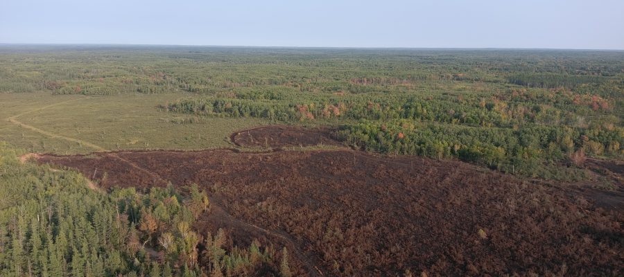
Aerial view of the County Rd 11 Fire from September 5, 2023. County Road 11 is visible on the left side of the photo. 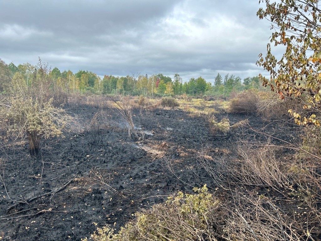
Black marshland grasses in the burned area of the County Rd 11 Fire. Credit to AJ Hoffman, US Fish and Wildlife Service 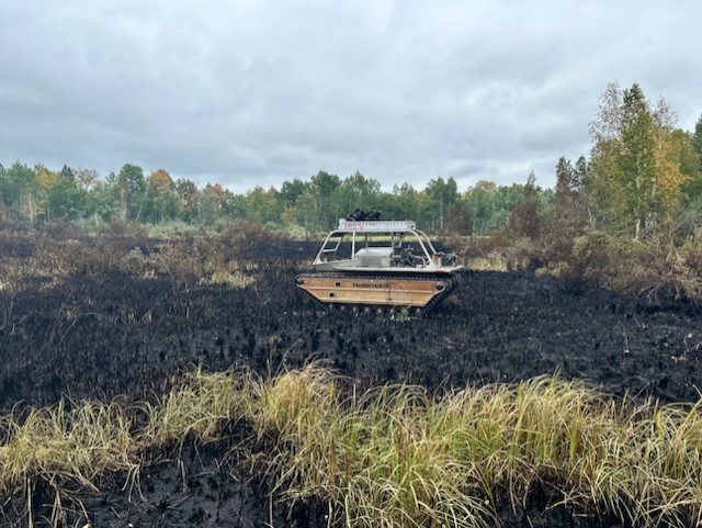
A Marsh Master tracked vehicle on the black marshland grasses in the burned area of the County Rd 11 Fire. Credit to AJ Hoffman, US Fish and Wildlife Service 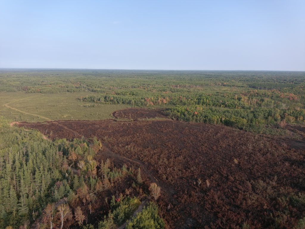
Aerial view 1 of the Cty Rd. 11 Fire on Sept. 8, 2023. Credit M. Halverson-MNICS Team B 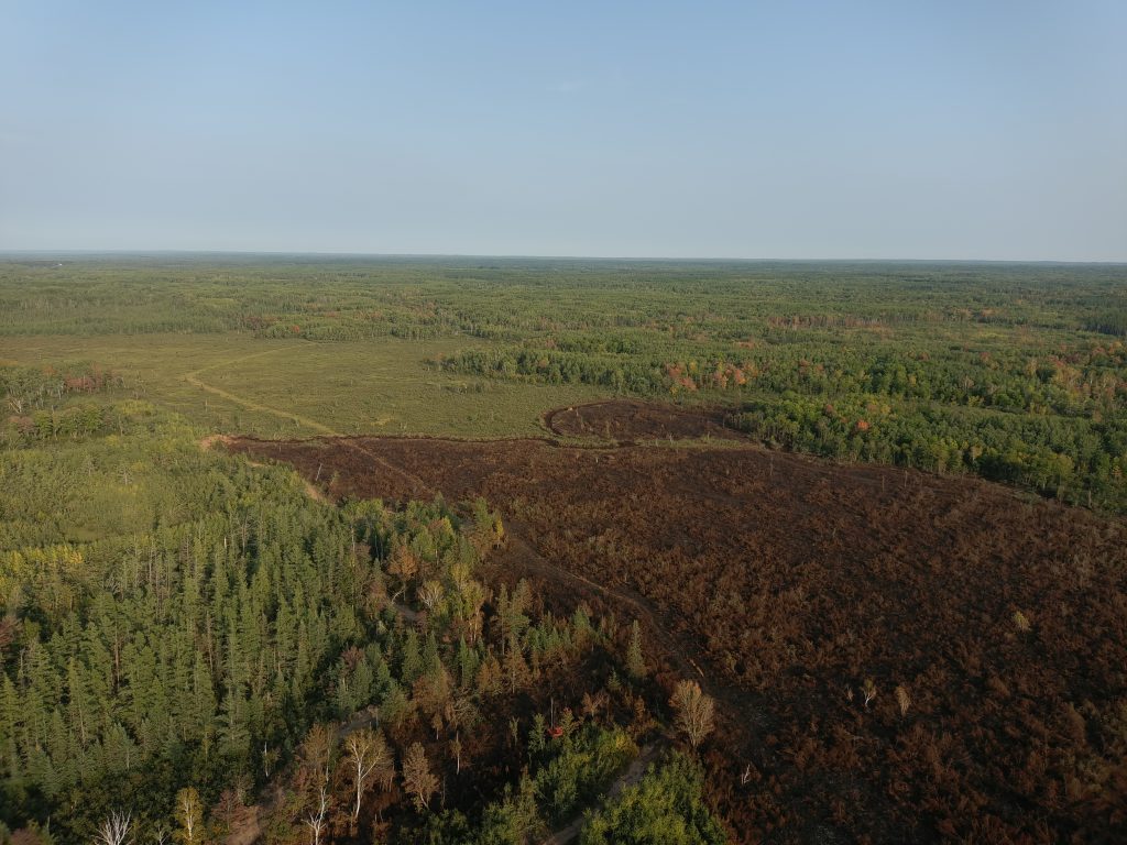
Aerial view 2 of Cty Rd 11 Fire on Sept. 8, 2023. Credit M. Halverson-MNICS Team B 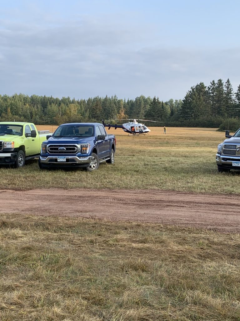
Support resources and a small helicopter at the staging area on County Rd. 11. Credit Val Cervenka-MNICS Team B 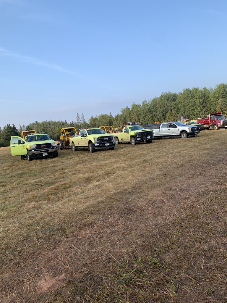
A line of resources parked at the staging area for morning briefing. Credit Val Cervenka-MNICS Team B 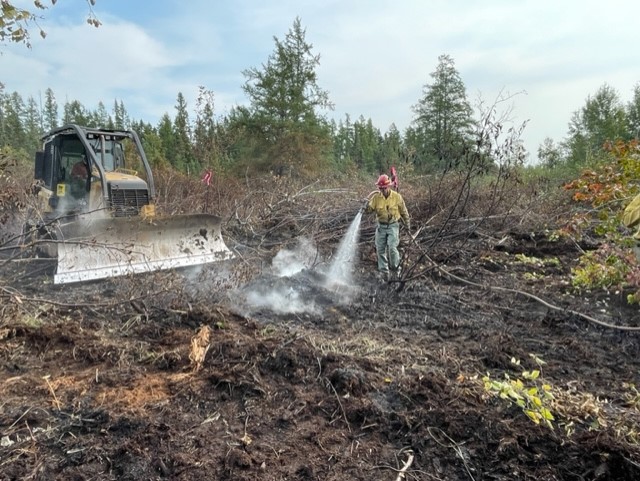
Firefighter Mike Treirwieler sprays the burning peat on September 9, 2023. Credit V. Cervenka-MNICS Team B 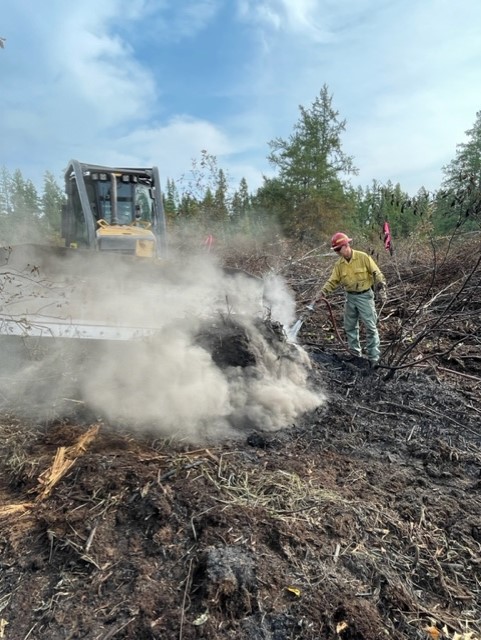
Firefighter Mike Treirwieler works with the dozer to extinguish the burning peat on September 9, 2023. Credit V. Cervenka-MNICS Team B 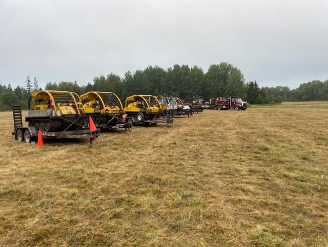
A line of J5s and other equipment at staging area. Credit Ryan Williams-MNICS Team B 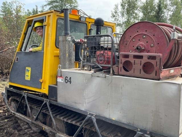
Firefighter Maddie Doucett drives a muskeg. Credit V. Cervenka-MNICS Team B 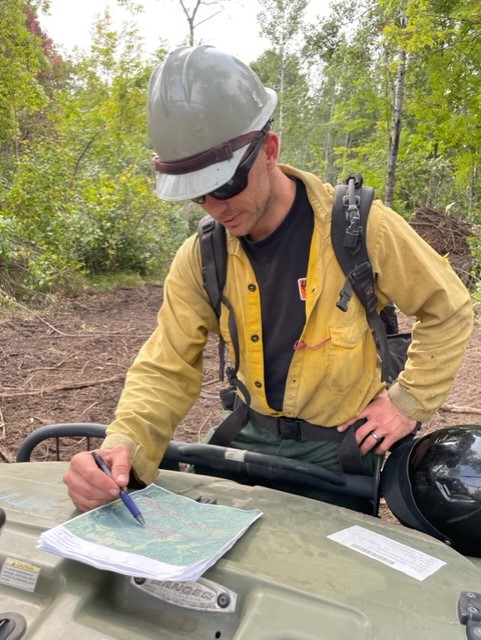
Ryan Williams-Incoming Div. Supv. reviews tactics. Credit V. Cervenka-MNICS Team B 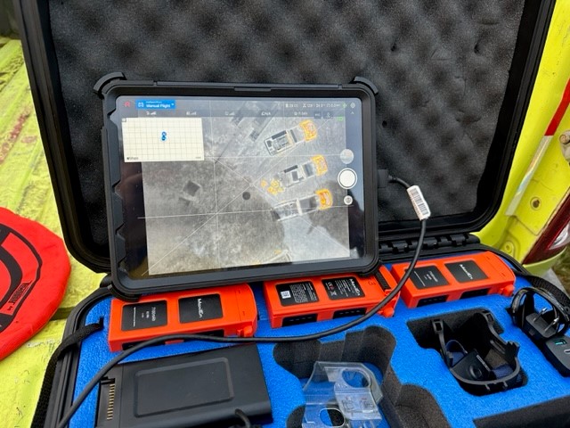
Drone equipment for conducting an infrared flight. Credit Aaron Mielke-MNICS Team B 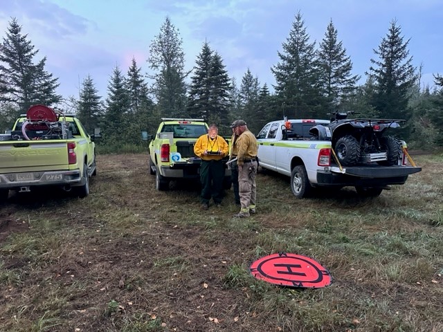
Fire managers on the team prepare for the infrared flight by setting up the drone. Credit Aaron Mielke-MNICS Team B 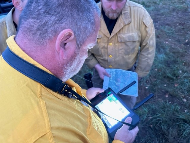
Liaison Marlyn Halvorson operates the drone device. Credit Aaron Mielke-MNICS Team B 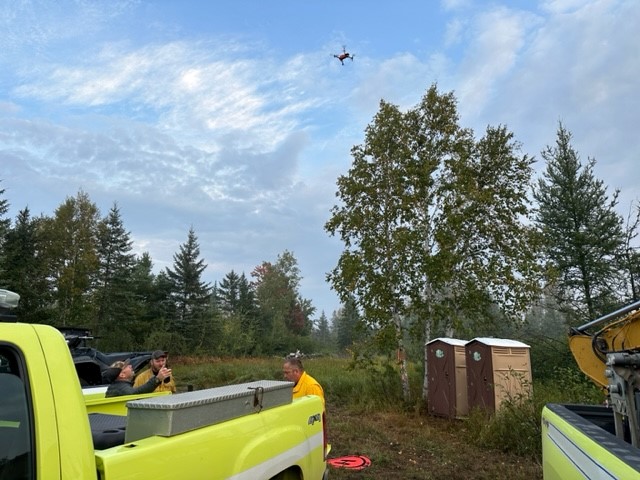
The drone starts collecting data for the fire team. Credit Aaron Mielke-MNICS Team B