Skip to content
  • HOME
  • ABOUT MNICS
  • ABOUT MIFC
  • CONTACT US

MNICS.org

  • INCIDENT INFORMATION
    • Minnesota Incidents
    • Inciweb
  • SERVICES
    • Member Support
    • Weather
    • Fuels / Fire Danger
    • Outlooks
    • Firewise Minnesota
  • MNCC DISPATCH / NEK
    • Minnesota Interagency Coordination Center
    • Aviation
    • Intelligence
    • Equipment / Supplies
    • Overhead / Teams
    • Crews
    • FORMS, GUIDES AND PLANS
    • Resource Statusing Page
  • ADMINISTRATIVE
    • MNICS Coordination
    • Outreach Resources
    • Policy, Plans and Guides
    • Incident Business
    • Forms
    • Safety Management
    • Training
  • RESOURCES AND LINKS
    • Photo Galleries
    • Eastern Area Coordination Center
    • All Regional Coordination Centers
    • National Coordination Center
  • Calendar
MNICS.org

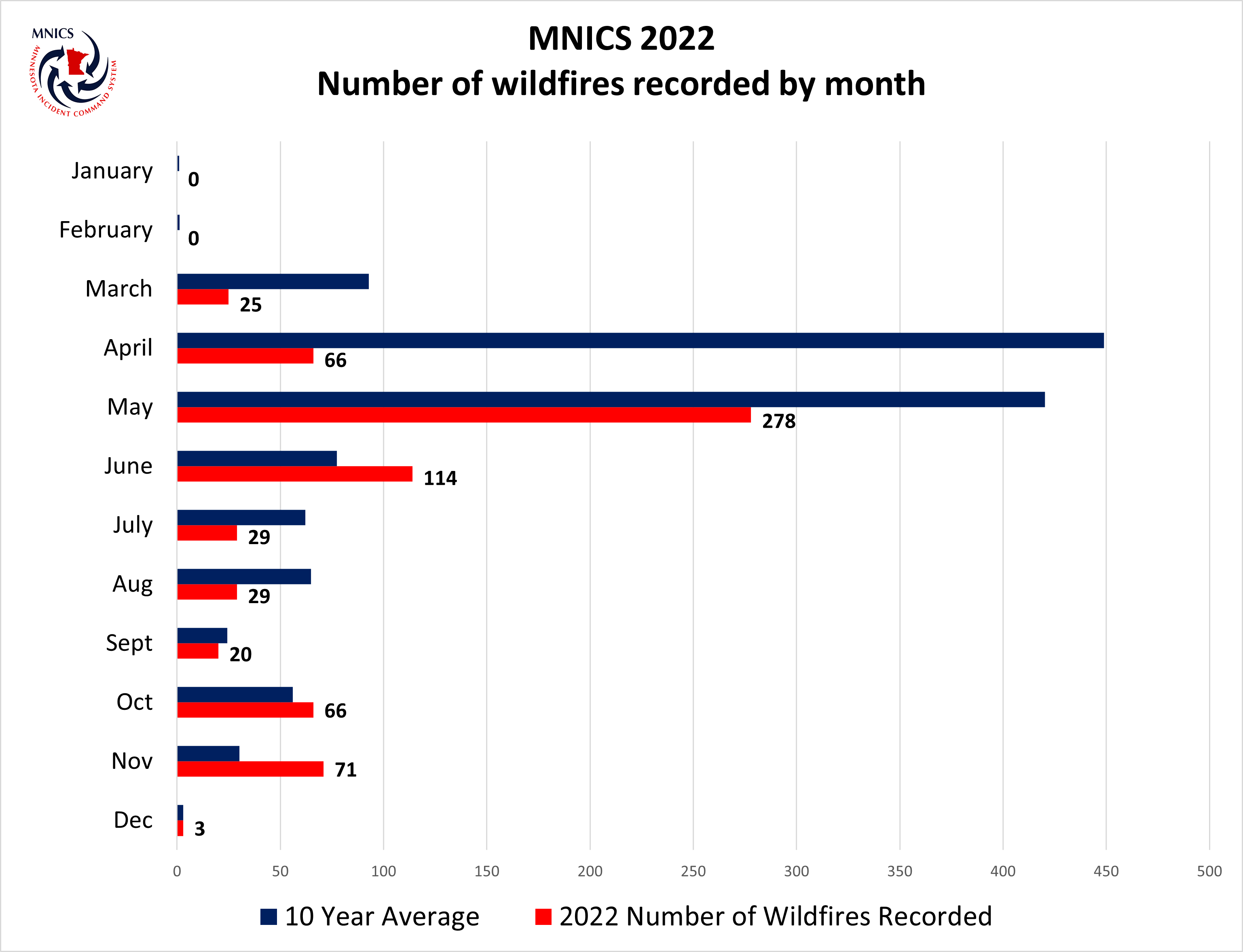
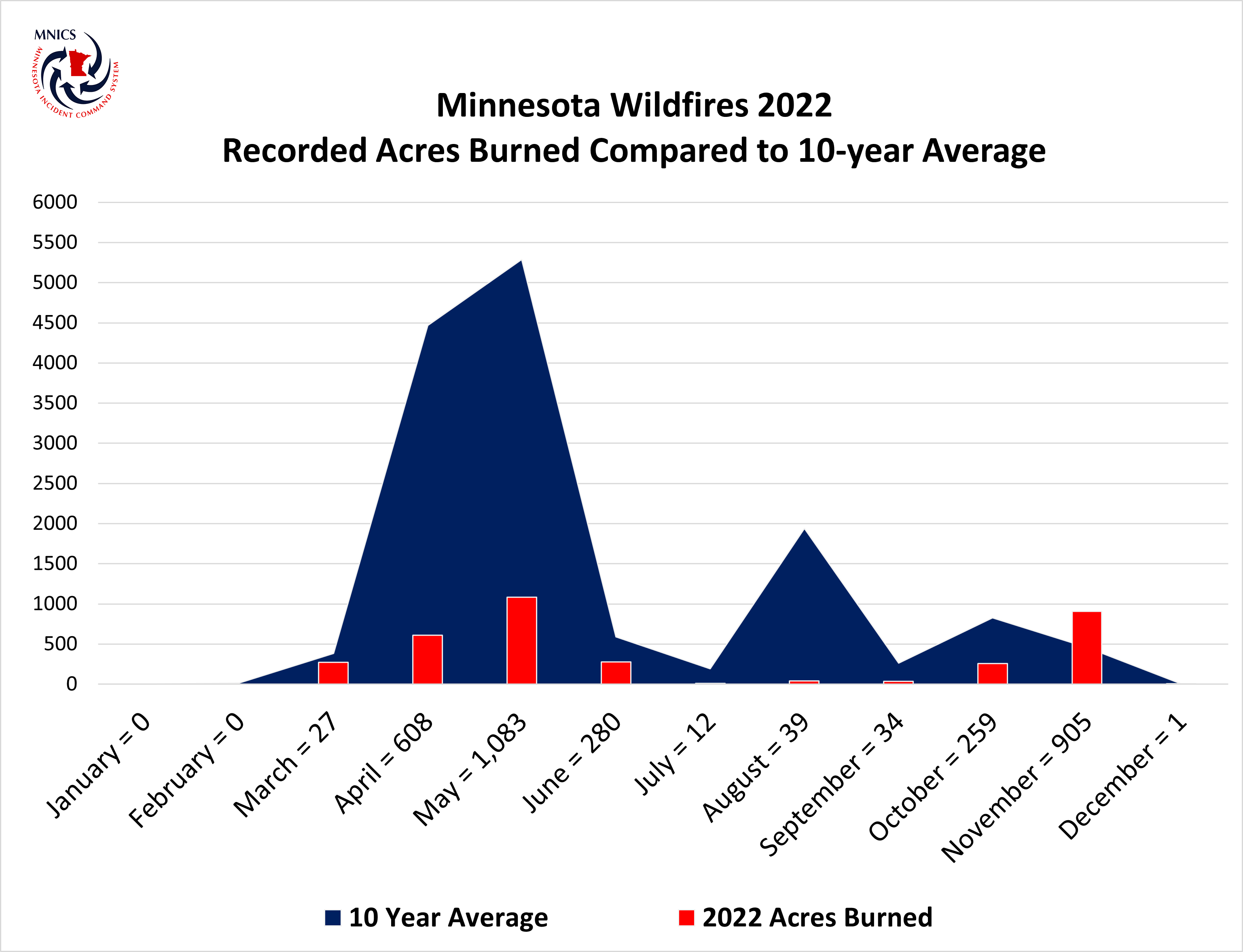
Minnesota 2022 Wildfire Data

The MNICS agencies recorded 701 wildfires that burned 3,492 acres in 2022.

Graph of two data sets comparing fire occurrence by month red bars current blue bars average.

Graph of comparing current acres burned in red bars to average blue bars.

2022 Notable Fire

Share this:

  • Click to print (Opens in new window) Print
  • Click to email a link to a friend (Opens in new window) Email

News

  • Camp House and Jenkins Creek Fire Update May 15, 2025
  • Munger Shaw Fire Update May 15, 2025
  • Camp House, Jenkins Creek, Munger Shaw Wildfire Update May 14, 2025

Current Preparedness Levels

  • Minnesota = 5
  • Eastern Area = 3
  • National = 2

Updated 5/14/2025

NIFC Predictive Services

National Significant Wildfire Potential Outlook
MN Fire Danger map

Current Conditions

Fire Danger

MN Fire Danger map

Facebook

Facebook
  • BIA
  • DNR
  • FS
  • FWS
  • HSEM
  • NPS
  • SFM
  • |
  • DISCLAIMER
  • ADMIN LOGIN
  • PRIVACY
  • CONTACT US
 

Loading Comments...
 

You must be logged in to post a comment.