
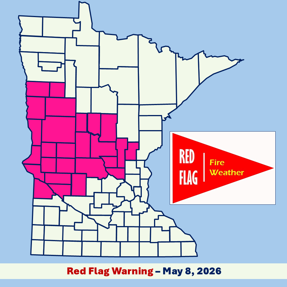
The National Weather Service has issued a Red Flag Warning for 26 counties in parts of central and northwest Minnesota effective today, May 8, from 1 p.m. until 6 p.m. due to extreme fire risk conditions. Weather conditions are expected to be dry and windy with west to northwest winds 15-25 mph gusting up to 35 mph and relative humidity around 20% forecast.
Affected counties include Becker, Benton, Big Stone, Cass, Chippewa, Clay, Crow Wing, Douglas, Grant, Kanabec, Kandiyohi, Lac Qui Parle, Mahnomen, Mille Lacs, Morrison, Norman, Otter Tail, Pope, Sherburne, Stearns, Stevens, Swift, Todd, Traverse, Wadena, and Wilkin.
A Red Flag Warning means fires can spread quickly and grow out of control under the predicted weather conditions, including low relative humidity and strong winds. Residents should not burn in counties where a Red Flag Warning is in effect and should also check any recent burning they did to ensure the fire is completely out. The DNR will not issue or activate open burning permits for large vegetative debris burning and discourages campfires during the Red Flag Warning. People should use caution when doing activities that can cause sparks or heat near vegetation by securing trailer chains, parking ATVs on gravel or pavement, and using chainsaws or other equipment outside of the Red Flag warning hours.
Fine fuels, such as grass and small twigs, can dry out quickly when the relative humidity is so low and wind pick up. These fine fuels can easily ignite and start a wildfire that spreads quickly.