
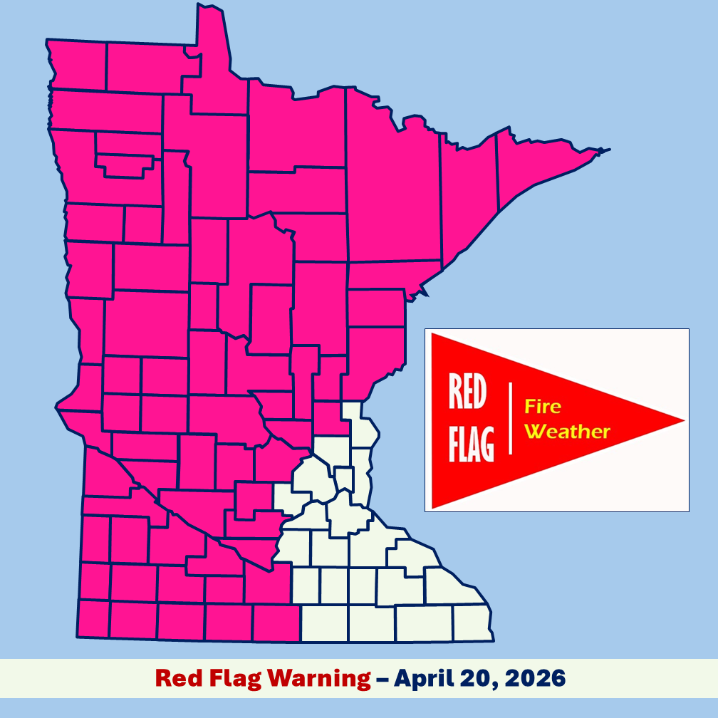
The National Weather Service has issued a Red Flag Warning for counties in Southwest and West Central Minnesota beginning today between 10 to 11 a.m. until 8 p.m., due to extreme fire risk conditions resulting from relative humidity ranging 20-25% and southerly winds gusting 30-40 mph.
Aitkin, Becker, Beltrami, Benton, Big Stone, Blue Earth, Brown, Carlton, Cass, Chippewa, Clay, Clearwater, Cook, Cottonwood, Crow Wing, Douglas, Faribault, Grant, Hubbard, Isanti, Itasca, Jackson, Kanabec, Kandiyohi, Kittson, Koochiching, Lac Qui Parle, Lake, Lake Of The Woods, Lincoln, Lyon, Mahnomen, Marshall, Martin, McLeod, Meeker, Mille Lacs, Morrison, Murray, Nicollet, Nobles, Norman, Otter Tail, Pennington, Pine, Pipestone, Polk, Pope, Red Lake, Redwood, Renville, Rock, Roseau, Sherburne, Sibley, St. Louis, Stearns, Stevens, Swift, Todd, Traverse, Wadena, Watonwan, Wilkin, Wright, and Yellow Medicine.
Red Flag Warning means fires can spread quickly and grow out of control under the predicted weather conditions, including strong winds with high gusts, and low relative humidity.
Where a Red Flag is in effect:
- Residents should not burn and should also check any recent burning they did to ensure the fire is completely out.
- The DNR will not issue or activate open burning permits for large vegetative debris burning.
- Campfires are discouraged.
- People should use caution when doing activities that can cause sparks or heat near vegetation by securing trailer chains, parking ATVs on gravel or pavement, and using chainsaws or other equipment outside of the Red Flag warning hours.
Red Flag Warnings are evolving situations. Visit the National Weather Service (weather.gov) for updates.